In shortRainbow Mountain altitude comes in two figures. Official catalogues give Vinicunca 5,036 m (16,522 ft) above sea level, while the Cusipata entry-registration platform and Peru's state news agency both put the site's highest point at 5,200 m, inside the Ausangate massif of the Vilcanota range. Walking begins at about 4,650 m and gains roughly 400 to 600 m. Cusco stands at 3,399 m (11,150 ft).
5,036 m (16,522 ft)Catalogued altitude
5,200 mSite's highest point
4,650 mPhulawasipata trailhead
3,399 m (11,150 ft)Cusco, your base
Rainbow mountain altitude: two figures for one summit
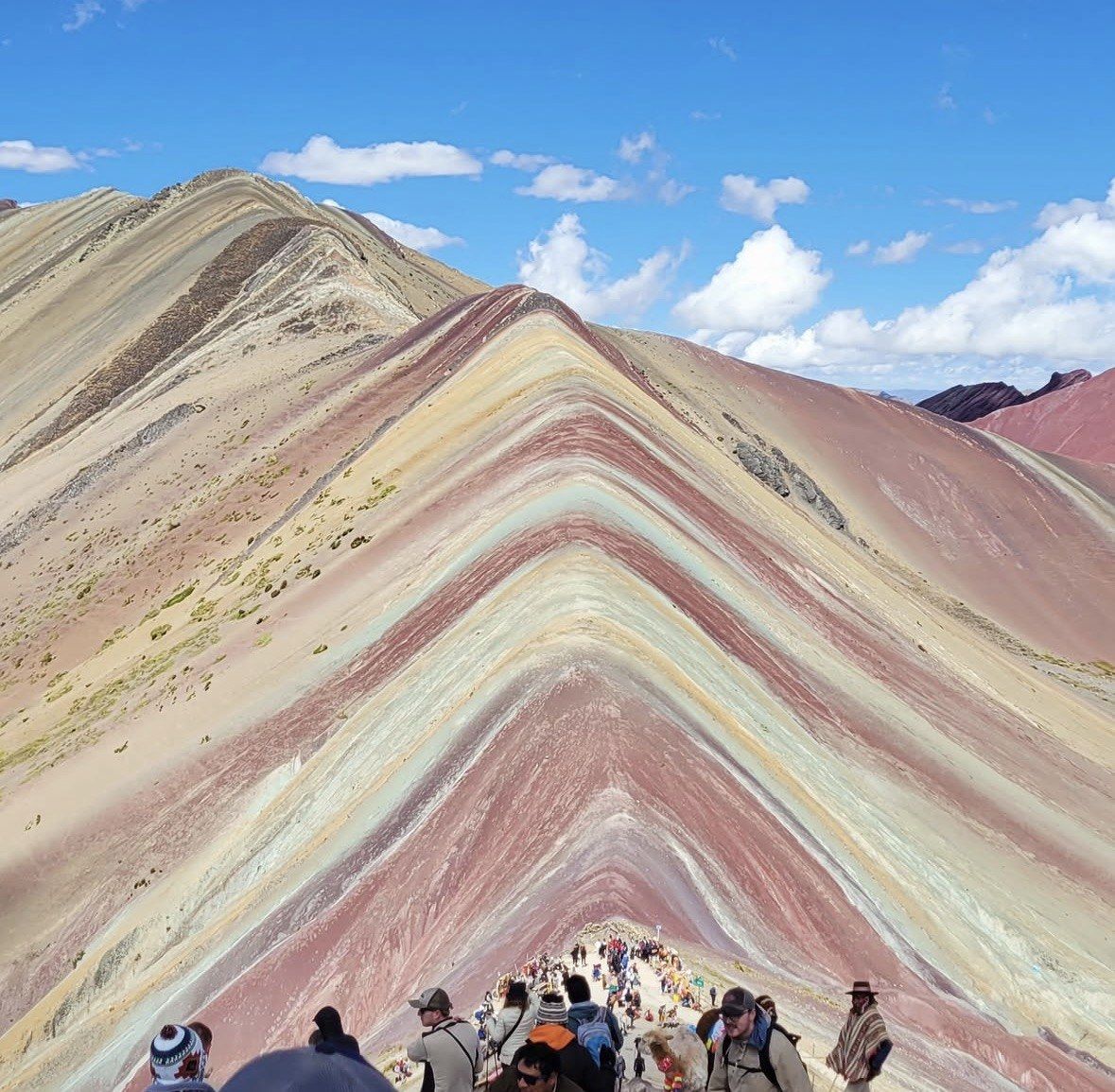
Vinicunca's officially catalogued altitude is 5,036 m (16,522 ft) above sea level. The registration platform run for the Cusipata access says 5,200 m, and Peru's state news agency prints the same 5,200 m for the summit viewpoint. Both numbers are in circulation, which is why the answer to how high Rainbow Mountain in Peru is changes depending on which page you opened.
The likely reason is what each figure refers to. A catalogued altitude is tied to one surveyed point on the mountain; the higher figure is described as the site's highest point, which takes in ground above the spot where most people stand for photographs. No surveying authority has published a reconciliation of the two, so expect to keep seeing them side by side.
For planning purposes the difference is academic. Use 5,036 m if you want the conservative number and 5,200 m if you want the one quoted at the entrance side of the operation. Either way you finish above 5,000 m, which is the figure your body reacts to.
Full-day trip with oxygen on the climb
This 12-hour departure from $22, rated 4.9/5 (4062 reviews), handles the long road and the meals and sends a professional guide with oxygen assistance and walking sticks for the stretch above 4,650 m.
★ 4.9/5 · 4,062 reviews
What you actually climb from the Cusipata trailhead
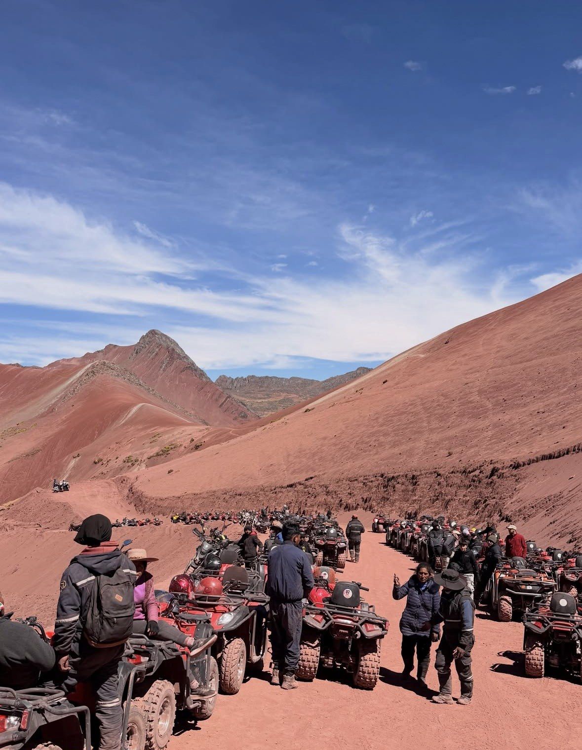
The vehicle does most of the vertical work on the Cusipata side. The road ends at the Phulawasipata parking area, roughly 4,650 m up and 109 km out from the city, so your legs are left with 400 to 600 m of ascent on a round trip measured at 7 km and timed at about three hours.
Distances stay small in both directions: 6 to 7 km (3.7 to 4.3 miles) from the trailhead to the viewpoint and back. Times do not behave the way the distance suggests. Plan on two to three hours going up and another hour and a half to two hours returning. Peru's state news agency times the ascent at 90 to 120 minutes, which is the pace of someone already settled into the altitude.
The last part of the gradient is the steepest and it ends on a flight of steps. Where a tour mentions horses on the lower trail, they do not reach the viewpoint, so that steep finish and the staircase are done on foot by everyone.
How Vinicunca's elevation compares to Cusco, Palccoyo and Machu Picchu
Cusco stands at 3,399 m (11,150 ft), high enough that most visitors notice the stairs in their hotel on arrival day. The mountain starts where the road stops, at about 4,650 m, so every metre of the walk happens above the altitude you have been sleeping at, and the viewpoint is higher again.
Set that against the rest of the region and the jump is easier to picture. Machu Picchu sits at 2,430 m (7,970 ft), nearly a kilometre below the city, which is why it feels like a different kind of day out. Among the coloured mountains, Palccoyo tops out at 4,971 m with 45 to 60 minutes of walking to the top, and Pallay Punchu rises above 4,700 m with operators working the slope between about 4,700 and 4,900 m.
| Place | Altitude | Note |
|---|
| Vinicunca, site's highest point | 5,200 m | Cusipata entry-registration platform and Peru's state news agency |
|---|
| Vinicunca, catalogued summit | 5,036 m (16,522 ft) | Official catalogue figure |
|---|
| Palccoyo | 4,971 m | 45 to 60 minutes on foot to the summit |
|---|
| Pallay Punchu | above 4,700 m | Slope worked between about 4,700 and 4,900 m |
|---|
| Phulawasipata trailhead, Cusipata route | about 4,650 m | Where the walking starts, 109 km from Cusco |
|---|
| Cusco | 3,399 m (11,150 ft) | Where you acclimatise before the mountain day |
|---|
| Machu Picchu | 2,430 m (7,970 ft) | About 80 km north-west of Cusco |
|---|
Thin air above 4,650 m and why your pace drops
The air up there is the same mixture you breathe at home. What changes is the pressure pushing it into your lungs, and with lower pressure each breath carries less oxygen to the muscles doing the climbing. Official reporting on the site puts it simply: the air is thin, the sun is intense and temperatures can drop sharply, so layers and sun protection belong in the bag in every month.
In practice you walk slower than you intend to. Breathing speeds up on gentle ground that would not register at sea level, conversation thins out, and you start pausing without having decided to pause. That is the gap between the 90 to 120 minutes quoted for a well acclimatised ascent and the two to three hours most visitors take on the same path.
The usual mistake is treating the figures as a measure of fitness. Six to seven kilometres with 400 to 600 m of climbing is an easy morning at low altitude; the same profile starting at 4,650 m is a long one, and arriving in Cusco a day earlier does nothing to change that.
The ice that hid the stripes until 2013
Vinicunca belongs to the Ausangate massif within the Vilcanota range, straddling Cusipata district in Quispicanchi province and Pitumarca district in Canchis. That setting is the reason for both the altitude and the colour: the bands were laid down by water that once covered the area, dated to the Tertiary and Quaternary, roughly two million years ago, and then lifted into mountains by tectonic movement.
Glacier caps covered the banded slopes for years. The ice had melted away by around 2013, leaving the strata exposed to humidity, oxidation and erosion, and visitors in numbers followed in the mid-2010s. The practical consequence for you is that the colour everyone comes for only exists at a height where walking is slow.
Acclimatise in Cusco before you take this on
The CDC asks for two to three nights at around 2,450 to 2,750 m before going higher, no more than about 500 m of extra sleeping altitude per night once above 3,000 m, and an additional acclimatisation night for every 1,000 m of sleeping altitude gained. It also advises mild exercise only during the first 48 hours at altitude and no alcohol in that window. Peru's tourism board calls acclimatising essential before attempting Vinicunca and suggests cardiovascular work in the days beforehand.
Read against the numbers on this page, that rules out the mountain on your first or second day in Cusco. Two to three nights in the city first, an easy arrival day with water and light meals, then the climb. If you have less time than that, or are travelling with children under 10, or have heart or back trouble, Palccoyo is the sensible substitute at 4,971 m with 45 to 60 minutes of walking to the top.
Headache is the symptom to watch for once you gain height, and there is a separate page on this site covering altitude sickness and what to do when it appears. On the mountain itself the support that matters is a guide with oxygen to hand, which is what the day trips listed here are set up to provide.
- Two to three nights at Cusco altitude before the mountain day
- Mild exercise only and no alcohol in your first 48 hours at altitude
- Layers and sun protection in any month: thin air, strong sun, sharp temperature drops
- Palccoyo at 4,971 m if your acclimatisation window is short
Questions people ask
Does the trail take you to the 5,036 m point itself?
The walk tops out at the viewpoint catalogued at 5,036 m (16,522 ft), reached after 400 to 600 m of climbing from the trailhead. The 5,200 m figure quoted by the Cusipata registration platform and Peru's state news agency refers to the site's highest ground rather than the spot where people stop for photographs. The final steep section and the staircase at the end are walked by everyone.
Would sleeping in the Sacred Valley help me handle the altitude?
It fits the CDC advice better than starting in Cusco. Urubamba lies at about 2,870 m (9,420 ft) and Ollantaytambo at 2,792 m (9,160 ft), with the valley floor dropping from about 3,000 m at Pisac, so those nights sit close to the 2,450 to 2,750 m band the CDC wants for your first two to three nights. Move up to Cusco at 3,399 m (11,150 ft) afterwards, then do the mountain.
Is oxygen available on the mountain?
The oxygen you can count on is the bottle your guide is carrying. Reputable operators send a first-aid-trained guide with bottled oxygen for altitude emergencies, and the full-day trip listed on this site includes oxygen assistance alongside walking sticks. Access is run by the local communities and there is no official visitor centre on the site, so do not plan on finding equipment at the trailhead.
What does the altitude mean for what I should wear?
Dress for cold dawns and strong sun on the same morning. At the Cusco airport station, 3,249 m, mean daily minima fall to 1.2 °C in July and 1.9 °C in June, and the trail starts far higher than that station. Official reporting on the site notes thin air, intense sun and sharp temperature drops, so layers plus sun protection are needed in every month.
Is this altitude suitable for children?
Children are technically admitted at the control point, but the hike is not recommended under 10 years of age, and no part of the route is wheelchair accessible. The combination of a pre-dawn road transfer, a start above 4,650 m and a staircase at the finish is a lot for small legs. Palccoyo, at 4,971 m with 45 to 60 minutes of walking, is the version families usually manage.
Read also