In shortTwo roads reach Vinicunca. The Cusipata approach to the Phulawasipata trailhead runs 109 km, around two hours of driving, and leaves you walking from about 4,650 m on a 7 km round trip of roughly three hours. Via Pitumarca, allow about three hours at the wheel through Andahuaylillas, Quiquijana and Checacupe, with the walk starting at Qheshiuno. Pickups in Cusco fall between 3:00 and 4:30 am.
109 kmCusipata route from Cusco
about 3 hoursDrive on the Pitumarca side
4,650 mPhulawasipata trailhead
3:00–4:30 amCusco pickup window
How to get to rainbow mountain from cusco: the two road approaches
Vinicunca sits on a district border, and that border is the reason there are two roads rather than one. The western side belongs to Cusipata district in Quispicanchi province, the eastern side to Pitumarca district in Canchis. Access on each side is controlled by a peasant community, Chillihuani in Cusipata and Pampachiri in Pitumarca, whose members also work as guides and muleteers. Both routes are reported to operate from 6:00 am to 5:00 pm, and a ticket issued on one route is reported to be good only for that route, so settle which side you are using before you leave Cusco.
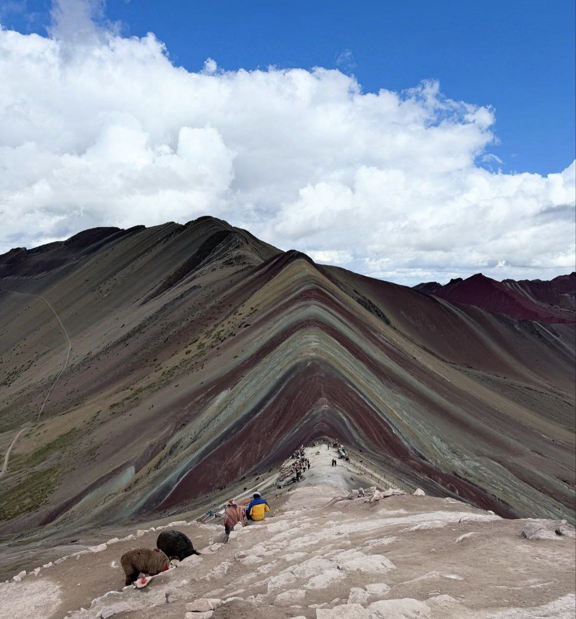
The Cusipata approach is the one most vehicles out of Cusco use. It measures 109 km by road and finishes at the Phulawasipata parking area at roughly 4,650 m, with a 7 km round trip of about three hours to the viewpoint and back and some 400 to 600 m of climbing in between. The shortest standard approach to the trailhead is quoted at about two hours of driving plus a walk of around 5 km.
The Pitumarca approach is the longer drive: about three hours by car or tour bus, running through Andahuaylillas, Quiquijana and Checacupe before reaching Pitumarca itself, with walking beginning in the community of Qheshiuno. The walk on either side comes out at 6 to 7 km (3.7 to 4.3 miles) return, and Peru's state news agency puts the ascent at 90 to 120 minutes, with 1.5 to 2 hours back down.
| Cusipata – Phulawasipata | Checacupe – Pitumarca |
|---|
| Road distance from Cusco | 109 km | Not published in the sources used here |
|---|
| Drive time | About two hours on the shortest standard approach | About three hours by car or tour bus |
|---|
| Places the road passes | Cusipata, the usual breakfast stop on the way | Andahuaylillas, Quiquijana, Checacupe, then Pitumarca |
|---|
| Where the walk begins | Phulawasipata parking area, about 4,650 m | Community of Qheshiuno |
|---|
| Walk to the viewpoint | 7 km round trip, about three hours | 6–7 km (3.7–4.3 miles) round trip, 2–3 hours up, 1.5–2 hours down |
|---|
| Climb from the trailhead | Roughly 400–600 m | Same ridge; trailhead altitude not published in these sources |
|---|
| Community running access | Chillihuani, Cusipata district (Quispicanchi) | Pampachiri, Pitumarca district (Canchis) |
|---|
| Reported hours | 6:00 am to 5:00 pm | 6:00 am to 5:00 pm |
|---|
| Ticket validity | Reported valid on this route only | Reported valid on this route only |
|---|
The standard Cusipata-side full day
This 12-hour departure from $22 covers the 109 km road to the Phulawasipata trailhead with breakfast, lunch, walking sticks and oxygen assistance, and the Red Valley left open as an option on the day.
★ 4.9/5 · 4,062 reviews
How far is rainbow mountain from cusco, and what the distance costs you
Peru's state news agency puts the coloured mountains just past the 100 km mark southeast of Cusco, in Canchis province. On the ground that translates into a half-day of road before any walking starts, which is why every standard trip runs 12 to 14 hours door to door.
The trade-off between the two sides is straightforward. Cusipata gives you the shorter day and the higher start: the car park at about 4,650 m does a chunk of the climbing for you, and the walk is 7 km return in roughly three hours. Pitumarca puts the extra hour into the road instead, approaching through a string of valley towns, and the walk starts lower in Qheshiuno. If you want the least time in a vehicle, take the Cusipata side.
Cusco stands at 3,399 m (11,150 ft), and stepping straight out of a van at 4,650 m to climb a further 400 to 600 m is where people come unstuck. The higher trailhead shortens the walk and does nothing for your lungs. The catalogued summit is 5,036 m (16,522 ft); the Cusipata entry-registration platform and Peru's state agency both put the site's highest point at 5,200 m. Allow 2 to 3 hours up, and more if this is your first week at altitude.
The shape of the travel day
Hotel pickup in Cusco happens in the dark, somewhere between 3:00 and 4:30 am, with 4:00 am the usual slot. Operators warn the time can slide by 30 to 45 minutes depending on how the collection round goes, so set the alarm for the earliest end of your window.
The vans break the drive with a breakfast stop in the valley before the climb to the trailhead; on the Cusipata side that stop is in Cusipata, where the ATV trip serves its buffet breakfast and lunch. Walking usually begins soon after first light. That early start is doing two jobs at once: the bands hold their deepest colour from 5 until 10 in the morning, and by 9:30 am the viewpoints are filling up and stay busy until midday, as the standard departures out of the city converge on the same trail within an hour or two of each other. Time at the top is spent at the main viewpoint, with the Red Valley added on tours that list it.
Coming down takes 1.5 to 2 hours, then there is lunch and the same road in reverse, with drop-off in Cusco in the late afternoon, around 5 to 6 pm. One Cusco operator states that walkers are admitted to the trail only until 2 pm, so a later start means an early-afternoon arrival on the ridge; confirm the cut-off with the operator before you commit to it. The private 08 am departure is the shortest day listed on this site at 10 hours.
Road conditions, high ground and closures
Both approaches leave the paved valley highway at some point and climb onto open puna, gaining well over a kilometre of altitude between Cusco and the trailhead. Dawn up there is cold: at Cusco airport (3,249 m) mean daily minima drop to 1.2 °C in July and 1.9 °C in June, and the mountain is far higher again. Official reporting on the site notes thin air, intense sun and temperatures that fall sharply, so layers and sun protection belong in the bag in every month of the year.
Closures come from the weather, and the rainy season is when they happen. Peru's tourism board warns that the drive to the trailhead runs significantly slower from November to April, months that bring rain and snow capable of covering the bands and blocking access altogether. Heavy rain and snowfall in February 2026 put a temporary suspension of visits under evaluation, with damage reported to bridges on the access roads. The call on closing rests with the Pitumarca and Cusipata municipalities acting jointly with the regional tourism office.
Plan the trip for the dry window of May to October, which Peru's state agency names as the best season, and reconfirm the night before with the operator. Vinicunca is open every day of the year apart from exceptional closures, and because access is community-run there is no single status page to refresh.
Which departure to book for the route you want
Standard group departures run the Cusipata side and leave in the small hours, which is the right call if you want the 5 to 10 am colour window. If you would rather walk after the morning wave has thinned, book the later private start instead and accept a mid-morning arrival.
- Excursion to Rainbow Mountain Full Day Optional Red Valley, from $22, 12 hours, rated 4.9/5 (4062 reviews): the small-hours standard departure, with collection from hotels in the city centre, an air-conditioned vehicle for the Cusipata road, breakfast and lunch either side of the walk, walking sticks, oxygen assistance and a professional guide working in English and Spanish; the Red Valley stays an open choice once you are up there. Vinicunca and Red Valley entrances are not included.
- Private Rainbow Mountain Tour - 08 am departure Skip the Crowds, from $149, 10 hours, rated 5.0/5 (342 reviews): private air-conditioned vehicle, hotel pickup and drop-off, a la carte lunch, oxygen to hand and an experienced guide. It is the shortest day listed here, and the one built around the later start.
- Tour ATV Rainbow Mountain and Red Valley from Cusco, from $90, 13 hours, rated 4.7/5 (110 reviews): round-trip tourist transport, quad bikes and safety equipment, buffet breakfast and buffet lunch in Cusipata, oxygen and first-aid kit, guide in Spanish and English, with the guide meeting you in the centre of the square. The final steep section and staircase are walked whatever you ride.
Questions people ask
Can I walk up one side and come down the other?
Plan on using a single route. The ticket issued at an access point is reported to be valid only for the road where it was bought, and the two trailheads are hours apart by vehicle. Vinicunca straddles Cusipata and Pitumarca districts, which run their own control points separately.
How high does the road itself climb?
From Cusco at 3,399 m (11,150 ft) the Cusipata road ends at the Phulawasipata parking area at about 4,650 m. The viewpoint above it is catalogued at 5,036 m (16,522 ft), with the Cusipata entry-registration platform and Peru's state news agency both citing 5,200 m for the site's highest point. The remaining 400 to 600 m is on foot.
Does the rainy season change the drive time?
Yes. Peru's tourism board warns that road travel to the trailhead is significantly slower from November to April, when rain and snow can also cover the coloured bands. Heavy weather has damaged access bridges, and visits were under evaluation for temporary suspension in February 2026.
What time do the access points open and close?
Reported hours on both approaches run 6:00 am to 5:00 pm, with the mountain working every day of the year except for exceptional closures. One Cusco operator states that walkers are admitted to the trail only until 2 pm. Check the timing with the operator on the day, since the figures are not published on an official government page.
Is the drive and walk suitable for young children?
Children are technically admitted, but the hike is not recommended under 10 years of age and the site is not wheelchair accessible. The hard part is the combination of a pre-dawn road transfer and 400 to 600 m of climbing above 4,650 m. Families who want a shorter day should look at the private later departure.
Read also