In shortWorth it if you have had two or three nights at Cusco altitude and can keep climbing for two to three hours from a trailhead at about 4,650 m, finishing on steps at a viewpoint catalogued at 5,036 m (16,522 ft). The bands are mineral and genuinely wide, though flatter than edited photographs, and strongest between 5 and 10 in the morning. Door to door the day runs 12 to 14 hours.
6-7 kmround trip on foot
5,036 mcatalogued viewpoint altitude
5 to 10 amstrongest colour window
up to 1,500visitors a day in high season
Is Rainbow Mountain worth it: the short verdict
Yes, if the altitude arithmetic works in your favour. What you are buying with the effort is 6 to 7 km (3.7 to 4.3 miles) of out-and-back walking and 400 to 600 m of climbing above a car park at roughly 4,650 m, ending at a viewpoint the official catalogue puts at 5,036 m (16,522 ft) and which both the Cusipata entry-registration platform and Peru's state news agency list at 5,200 m. Nothing on the route is technical. What empties people's legs is the air, and time in Cusco fixes that better than training does.
Say no if the mountain falls on your first or second day in the region. Cusco already stands at 3,399 m (11,150 ft), the CDC asks for mild exercise only and no alcohol in the opening 48 hours at altitude, and its core rule is to stop going higher while symptoms of altitude illness are already with you. Peru's tourism board is just as blunt about acclimatising before attempting Vinicunca, and suggests some cardiovascular work in the weeks beforehand.
Travellers who come back calling Vinicunca a letdown have usually arrived in the wrong hour. The bands look best early and the viewpoints fill late in the morning, and a standard departure can land you in the gap between those two things. The fix is the hour you book, covered further down.
Rainbow mountain photos vs reality
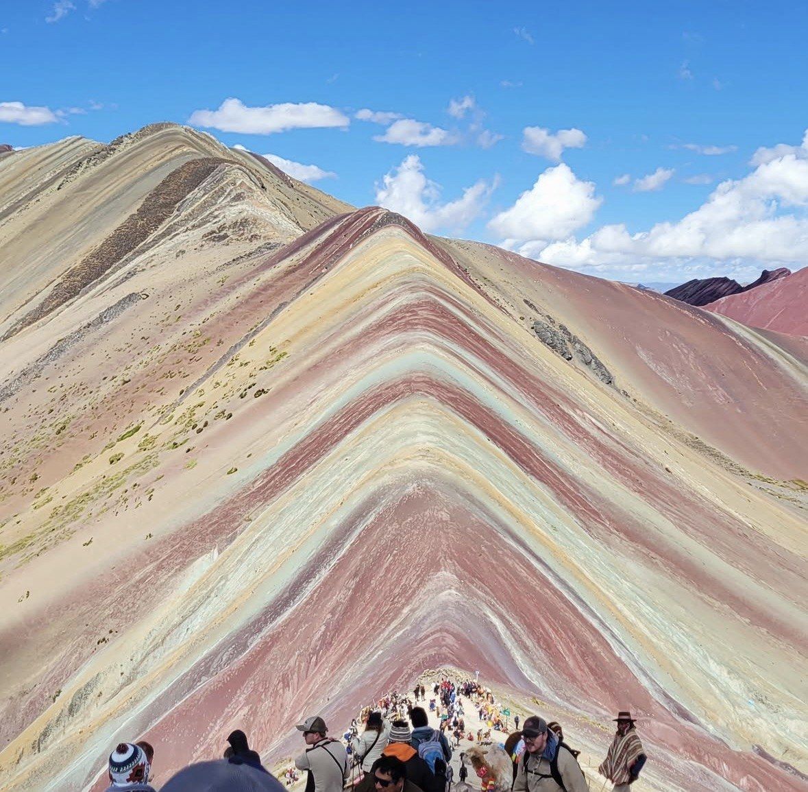
The colour is rock chemistry. Red comes from iron-bearing claystones and clays of Upper Tertiary age, mustard-yellow from calcareous sandstone rich in sulphur minerals, green from phyllite and clay rich in ferromagnesian minerals with no vegetation involved at all, pink and fuchsia from red clay, mud and sand, white and cream from quartzose material, sandstone and marl heavy in calcium carbonate, and earthy brown from Quaternary fanglomerate carrying magnesium-bearing rock. Water once covered the area and left those sediments, dated to the Tertiary and Quaternary and roughly two million years old, before tectonic movement lifted them into mountains and humidity-driven oxidation plus erosion put the bands on show.
Expect matte earth tones, with hard edges where the sun is still low. Saturation in an unedited frame sits well below what a feed shows you, and the stripes read widest early in the day. They are at their most vivid roughly between 5 and 10 in the morning, and cloud at that height arrives and leaves in minutes, so a few minutes of shade can flatten the whole ridge while you are standing in front of it.
Season moves the picture more than any camera setting. From November to April rain and snow can lie over the coloured slopes, which is where the photographs of a pale hill with faint pink edges come from, and road travel to the trailhead slows down in the same months. Peru's state agency names May to October as the season to come; operators widen that to April through October and single out May to September for clear skies.
One detail explains why the mountain photographs the way it does at all: glacier caps covered these strata until the ice went by around 2013, and mass tourism followed in the mid-2010s. The stripes you have seen online have been exposed to weather for barely more than a decade.
The plain full day, from $22
If your verdict is yes and you want the standard version of the day, this 12-hour departure handles the road and the meals and sends walking sticks and oxygen assistance along for the climb, from $22 and rated 4.9/5 (4062 reviews).
★ 4.9/5 · 4,062 reviews
The hours the day takes from Cusco
The walking is around three hours and the commitment is 12 to 14. Pickups from Cusco hotels sit between about 3:00 and 4:30 am, with 4:00 am the usual slot and operators warning it can slide by 30 to 45 minutes, and drop-off back in the city lands around 5 to 6 pm. The Cusipata approach covers 109 km and about two hours of driving to the Phulawasipata parking area; the Pitumarca side takes roughly three hours by road, through Andahuaylillas, Quiquijana and Checacupe, with walking beginning at Qheshiuno.
On the trail itself, count 2 to 3 hours of climbing and 1.5 to 2 hours coming back, with Peru's state agency timing the ascent at 90 to 120 minutes for someone already settled into the altitude. All of that has to fit inside a reported operating window of 6:00 am to 5:00 pm on both access routes, open every date of the year bar exceptional closures, and one Cusco operator puts the last admission onto the trail at 2 pm. None of those hours appears on a government page, so treat them as reported figures and confirm with the operator when you book.
February 2026 shows what an exceptional closure looks like in practice: heavy rain and snowfall damaged the access bridges and a temporary suspension of visits went under evaluation, a call made jointly by the Pitumarca and Cusipata municipalities with the regional tourism office. Reconfirm the night before in the wet half of the year.
How many people you share the ridge with
Only Machu Picchu pulls more visitors in the Cusco region. The May to October high season brings up to 1,500 people a day to Vinicunca, low season drops to around 600, and Peru's state agency has reported days reaching 2,000 since the site opened to tourism. Expect company, especially in June, July and August.
Colour and crowds run on clocks that barely overlap in your favour. Strongest colour falls between 5 and 10 in the morning; the viewpoints are fullest from 9:30 until midday, when the standard departures out of the city all pull in together. Book a small-hours start, be on the ridge inside the early window and begin the descent as the buses arrive, and the same mountain gives you a different day.
Crowding is also the honest argument against calling the place overcrowded on principle. Two thousand people spread over a 6 to 7 km out-and-back with a single staircase feels like a queue for twenty minutes near the top and like open puna everywhere else, provided you are not in the 9:30 to midday block.
What surrounds the coloured ridge
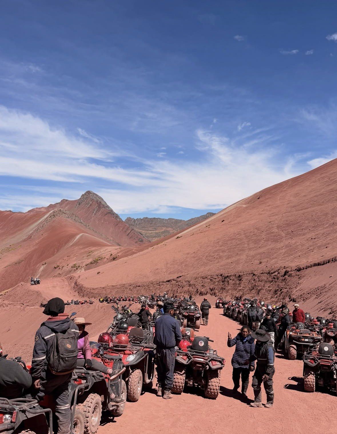
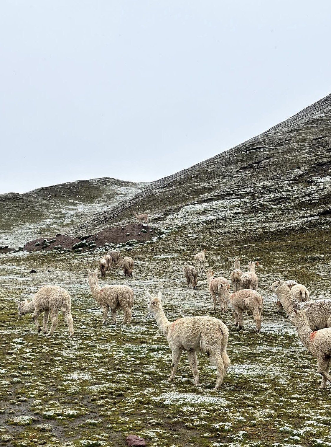
The stripes are one item in a much larger landscape. Vinicunca sits inside the Ausangate massif of the Vilcanota range, a little over 100 kilometres southeast of Cusco, and the walk up crosses high puna with herds of alpaca and llama working the slopes. The Red Valley viewpoint lies next door and has its own separate entrance, which on the tours here is a decision you can take on the day.
Entry is controlled by the two peasant communities whose land the mountain crosses. Chillihuani in Cusipata district, Quispicanchi province, runs one side and Pampachiri in Pitumarca district, Canchis province, the other, with community members working as guides and muleteers; the mountain straddles both districts and both provinces, and there is no official visitor centre, postal address or telephone anywhere on site. Reports say a ticket works only on the route where it was issued, so swapping sides once you are up there is not an option.
The mountain has also been fought over. A metallic mining concession of about 400 hectares covering the whole of it was granted in March 2018, renounced by the company in May 2018 after protests, followed by a 12-month mining moratorium and then the creation of the Ausangate Regional Conservation Area in 2019.
On-site conduct is simple and worth honouring: keep to the marked trail, leave the apachetas, the sacred stone cairns, as you found them, carry your rubbish back down, do not fly a drone without a permit and do not lean over edges for a photograph.
Verdicts by traveller type, and the gentler options
Pick on an honest reading of your own week rather than on what you want to be true.
Palccoyo and Pallay Punchu are covered on their own pages of this site, and the numbers below are the reason they exist as alternatives.
- Short Cusco stay, under two days at altitude: do not go to Vinicunca. Palccoyo tops out at 4,971 m and asks 45 to 60 minutes of walking to the top, with round-trip hiking rated at 2 to 3 hours against 3 to 4 at Vinicunca.
- Low tolerance for cold dark starts: no coloured-mountain day avoids the pre-dawn pickup, which runs from about 3:00 to 4:30 am across the board. What changes is how many hours you then spend on open ground, where dawn minima at the nearest long-record station, Cusco airport at 3,249 m, average 1.2 °C in July and 1.9 °C in June and the site is far higher again.
- Families: under-10s do get through the control point, but the ascent is not recommended for them and no stretch of the route is wheelchair accessible. A 45 to 60 minute walk at Palccoyo is the version small legs finish smiling.
- Keen hikers: this is the one to do. The distance is modest and the 400 to 600 m of gain above 4,650 m is the whole point, and the Red Valley adds a second viewpoint for very little extra walking.
- Photographers: worth it only with a small-hours departure, aiming for the 5 to 10 am window in the dry season, off the ridge before 9:30. Remember that drones need a permit.
- Anyone counting on riding past the hard part: horses do not reach the viewpoint, and the final steep section and the staircase are walked by everybody.
| Mountain | High point | Walk to the viewpoint | Round-trip hiking | Visitors a day |
|---|
| Vinicunca | Catalogued 5,036 m (16,522 ft), listed as 5,200 m by the Cusipata platform | 2 to 3 hours up, 1.5 to 2 hours down | 3 to 4 hours | High season peaks at 1,500, low season nearer 600 |
|---|
| Palccoyo | 4,971 m, open to tourism since 2018 | 45 to 60 minutes to the top | 2 to 3 hours | Up to 70 a day counted together with Pallay Punchu |
|---|
| Pallay Punchu | Over 4,700 m, with operators working the 4,700 to 4,900 m band | 45 minutes to an hour | 1 to 2 hours | Up to 70 a day counted together with Palccoyo |
|---|
Questions people ask
Is Rainbow Mountain overrated?
It is overrated by anyone who treats it as a photo stop and books a departure that reaches the viewpoint between 9:30 am and midday, when the colour has already softened and the standard buses converge. Arrive inside the 5 to 10 am window in the dry season and the judgement changes. The real complaint people have is about spending a 12 to 14 hour day for twenty minutes of good light.
What are rainbow mountain expectations most people get wrong?
Two things. The colours are mineral and muted rather than saturated, with green coming from ferromagnesian phyllites and clays rather than any plant life. And the effort is misjudged: 6 to 7 km (3.7 to 4.3 miles) sounds like an afternoon stroll until you start it at about 4,650 m and climb 400 to 600 m to finish on steps.
Can I use the Cusco Tourist Ticket for the coloured mountain?
No. At S/130 the integral Boleto Turístico buys three circuits of city, Valle Sur and Sacred Valley sites, and Vinicunca appears on none of them. Access is controlled by the communities of Chillihuani and Pampachiri, independently of that ticket. On the tours listed here, the entrance is either stated as included or stated as not included.
Which month gives the best chance of vivid bands?
May to October is the window Peru's state agency names, with operators pointing at May to September for clear skies. The rainfall split is stark at the nearest long-record station, Cusco airport at 3,249 m: 153.4 mm across 19.6 rain days in January against 3.3 mm and a single such day in June. Treat January to March as a gamble and February as effectively off-season.
What happens if the mountain closes for weather after I book?
Closures are decided jointly by the Pitumarca and Cusipata municipalities with the regional tourism office, and there is no single official status page to watch, so your operator is the channel. That is what happened in February 2026, when damage to the access bridges after rain and snowfall put a temporary suspension of visits under evaluation. Between November and April, check with the operator the night before your departure and again if the previous days have been wet.
Read also