In shortVinicunca is the famous striped ridge: catalogued at 5,036 m (16,522 ft), 6-7 km (3.7-4.3 miles) round trip with 400-600 m of climbing, and up to 1,500 visitors a day in high season. Palccoyo tops out at 4,971 m with a 45-60 minute walk; Pallay Punchu sits above 4,700 m and needs 45 minutes to an hour. Go to Vinicunca for the colour bands, to the other two if the climbing is the problem.
5,036 mVinicunca catalogued altitude
4,971 mPalccoyo high point
4,700-4,900 mPallay Punchu working range
up to 70 a dayPalccoyo and Pallay Punchu together
Pallay Punchu vs Rainbow Mountain at a glance
Of the three, Rainbow Mountain (Vinicunca) is the one with a district on each side: its colour-banded ridge marks the boundary between Cusipata, in Quispicanchi province, and Pitumarca, in Canchis, inside the Ausangate massif of the Vilcanota range. Two altitudes circulate for it, which matters once you line it up against the alternatives: 5,036 m (16,522 ft) as catalogued, and 5,200 m for the site's highest point according to the Cusipata entry-registration platform and Peru's state news agency. Pallay Punchu is a different kind of mountain: a jagged rock formation on the border of Layo district in Canas province and Marangani in Canchis, rising above 4,700 m. Palccoyo, the third option, tops out at 4,971 m.
Effort separates them more than looks do. Operators rank round-trip hiking at 3-4 hours for Vinicunca, 2-3 hours for Palccoyo and 1-2 hours for Pallay Punchu, with crowd levels rated high, medium and low in the same order. Cusco's regional tourism authority has reported Palccoyo and Pallay Punchu receiving up to 70 tourists a day between them, against up to 2,000 a day recorded at Vinicunca.
Two things decide it: your lungs and your calendar. If you have had 48 to 72 hours at Cusco's 3,399 m (11,150 ft) and can manage 400 to 600 m of climbing that begins at about 4,650 m and finishes on a flight of steps, go to Vinicunca, because that is the mountain you have seen in every photograph. If your acclimatisation window is shorter, if you are travelling with children under 10, or if heart or back trouble makes a sustained climb unwise, pick Palccoyo or Pallay Punchu instead.
Vinicunca is the ridge everyone means
Vinicunca lies a little over 100 kilometres south-east of Cusco. At best you are looking at about two hours in the vehicle plus some 5 kilometres on foot to the viewpoint, which is already more walking than either of the other two mountains asks of you. On the Cusipata side the total from Cusco is 109 km, ending at the Phulawasipata parking area at about 4,650 m, from where the round trip is 7 km and takes around three hours. Come in through Pitumarca and the drive stretches to about three hours by car or tour bus, Peru's state news agency reports, through Andahuaylillas, Quiquijana and Checacupe, with boots on the ground in the community of Qheshiuno.
The walking figures are modest; the altitude is what you will feel. Budget 2 to 3 hours for the climb and 1.5 to 2 hours for the way down; the 90 to 120 minutes the state agency quotes for the ascent belongs to walkers already settled into the height, and even that is double what the other two mountains ask. Both entry points belong to peasant communities rather than to a park service: Chillihuani on the Cusipata side, Pampachiri on the Pitumarca side, with community members working as guides and muleteers.
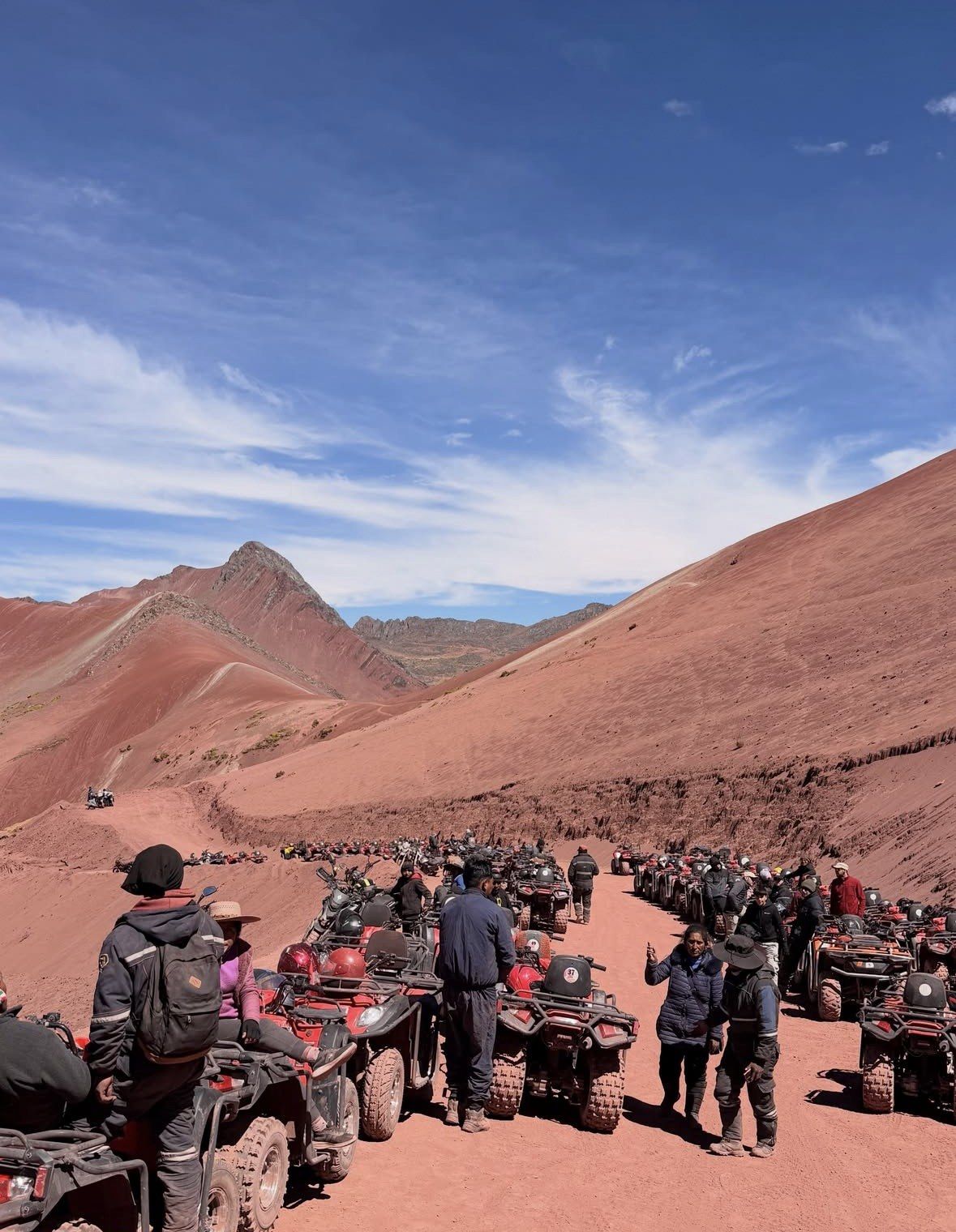
It still draws the most visitors for two reasons. The colour sequence is the strongest of the three, a cross-section of marine, lake and river sediments from the Tertiary and Quaternary, lifted by tectonic movement and exposed by oxidation and erosion once the glacier cap melted away by around 2013. And it has the reputation: in the Cusco region only Machu Picchu is visited more. High season from May to October brings as many as 1,500 people a day, dropping to around 600 once the rain starts, with the viewpoints at their fullest between 9:30 am and midday while the colours read strongest between 5 and 10 in the morning.
Two limits matter when you compare it with the gentler mountains. Under-10s are let through the control point, but the walk is not recommended for them, and no part of the route is wheelchair-accessible. Nor does paying for a horse buy you out of the climb, because the last steep pitch and the staircase are done on foot.
The full day to Vinicunca from Cusco
Once the comparison lands on the banded ridge, the standard full day is the usual way in: 12 hours from $22, rated 4.9 ★ (4062 reviews), with hotel pickup in the city centre, breakfast and lunch, walking sticks, oxygen assistance and a guide in English and Spanish; the Red Valley stays a decision for the day itself.
★ 4.9/5 · 4,062 reviews
Where Palccoyo is and how long the walk takes
Palccoyo sits in Canchis province, south-east of Cusco along the same corridor that serves Vinicunca's Pitumarca side. Peru's state news agency places it in Checacupe district in one report and in Combapata district in another, so expect the district name to vary in what you read. No official drive time from Cusco is published for it, which is worth confirming with the operator you book.
The numbers that matter are the altitude and the walk. Palccoyo tops out at 4,971 m, only a little below Vinicunca's catalogued height, and the walk to the summit takes 45 to 60 minutes. Operators rate the round-trip hiking at 2-3 hours and crowd levels as medium. It opened to tourism in 2018, after Vinicunca, which is part of why it is quieter.
This is the pick for travellers who want colour-banded hillsides without the long climb: short trips with limited acclimatisation, families with younger children, anyone who has had a rough first day or two in Cusco. Note that the tours listed on this site all run to Vinicunca and the Red Valley, so a Palccoyo day is a separate booking with a different itinerary.
Pallay Punchu, the jagged ridge on the Layo border
Pallay Punchu is reached from either the Layo side in Canas province or the Marangani side in Canchis, and it looks nothing like the other two. Instead of broad bands across a rounded slope, you get a row of sharp rock blades whose formation is described as close to 250 million years old, a far older sequence than Vinicunca's two-million-year sediments.
Altitude is the lowest of the three: the mountain rises above 4,700 m and operators work the slope between roughly 4,700 and 4,900 m. The state agency puts the walk to the main viewpoint at 45 minutes to an hour, and operators rate round-trip hiking at 1-2 hours with low crowd levels.
The cost of that quiet is road time. One licensed Cusco operator's Pallay Punchu day collects guests from the hotel at about 4:00 a.m., drives roughly four hours, tops out at 4,730 m and covers 3 km on foot in 1-2 hours; no official drive time or distance has been published for the route. The day therefore runs as long as a Vinicunca day even though the walking is shorter. Pallay Punchu suits photographers after an unusual silhouette and anyone who would rather share a viewpoint with a handful of people than with several hundred.
Altitude, walking and crowds side by side
The table draws on Peru's state news agency, the catalogued altitude for Vinicunca, the Cusipata registration platform and the crowd and hiking ratings published by licensed Cusco operators. Drive times are left out where no figure has been published.
| Mountain | Altitude | Walk to the viewpoint | Round-trip hiking (operator rating) | Crowds | Where it is |
|---|
| Vinicunca (Rainbow Mountain) | 5,036 m (16,522 ft) catalogued; 5,200 m per the Cusipata platform and the state agency | 6-7 km (3.7-4.3 miles) round trip from about 4,650 m, 400-600 m of climbing; 2-3 h up, 1.5-2 h down | 3-4 hours | High: up to 1,500 a day in high season, around 600 in low season, up to 2,000 reported | Cusipata district (Quispicanchi) and Pitumarca district (Canchis), a little over 100 km south-east of Cusco |
|---|
| Palccoyo | 4,971 m | 45 to 60 minutes to the top | 2-3 hours | Medium | Canchis province; Checacupe in one state-agency report, Combapata in another |
|---|
| Pallay Punchu | Above 4,700 m; slope worked between about 4,700 and 4,900 m | 45 minutes to an hour to the main viewpoint | 1-2 hours | Low | Border of Layo district (Canas) and Marangani (Canchis), reached from either side |
|---|
Which one to choose, by type of traveller
Pick on acclimatisation first and scenery second. The altitude is what ruins these days, so count your nights in Cusco first.
- Strongest scenery: Vinicunca. The banded ridge is the reason the region became a destination, and nothing at Palccoyo or Pallay Punchu matches the colour sequence.
- Easiest on the lungs: Pallay Punchu, lowest of the three above 4,700 m and shortest on foot at 45 minutes to an hour, with round-trip hiking rated 1-2 hours.
- Quietest: Pallay Punchu again, rated low for crowds, with Palccoyo and Pallay Punchu together drawing up to 70 visitors a day against Vinicunca's thousands.
- Best for families: Palccoyo. A 4,971 m high point reached in 45 to 60 minutes of walking keeps the day inside a child's limits. Vinicunca's climb is advised against under 10 years of age.
- Only one day available: Vinicunca, but only if you have already spent two or three nights at Cusco altitude. The 12-hour days from the city handle the road, the meals and the oxygen, which is what makes a single spare day workable.
- Short on acclimatisation but set on a coloured mountain: Palccoyo, which gives comparable banding for a fraction of the climbing.
Questions people ask
Is Pallay Punchu the same as Rainbow Mountain?
No. Rainbow Mountain is Vinicunca, the banded ridge in the Ausangate massif catalogued at 5,036 m (16,522 ft). Pallay Punchu is a separate mountain on the Layo and Marangani border, a jagged formation above 4,700 m with a much older rock sequence, described as close to 250 million years of geological formation.
Which rainbow mountain is the easiest to visit?
Pallay Punchu asks the least of your legs: 45 minutes to an hour to the main viewpoint, rated 1-2 hours of round-trip hiking, from the lowest high point of the three. Palccoyo is next at 4,971 m with a 45 to 60 minute walk and 2-3 hours of round-trip hiking. Vinicunca is clearly the hardest, with 6-7 km (3.7-4.3 miles) and 400-600 m of climbing from about 4,650 m.
Can I combine two coloured mountains in one day?
Treat each as its own day. A Vinicunca trip from Cusco runs about 12 to 14 hours door to door with a pickup in the small hours, and the tours listed here are 12 and 13 hours. Pallay Punchu sits in a different valley with an operator-quoted drive of roughly four hours each way, so nothing sensible fits alongside it.
Does hiring a horse make Vinicunca as easy as Palccoyo?
It does not. A horse stops short of the viewpoint, which leaves the steep finish and the staircase to your own legs however you covered the lower slope. If the climbing is the problem rather than the distance, Palccoyo's 45 to 60 minute walk to a 4,971 m summit is the better answer.
Do all three mountains have the same season?
Peru's state news agency names May to October as the best window for the coloured mountains, with operators widening it to April-October and calling May to September ideal. November to April is the same story on all three: rain and snow can bury the bands and shut access, and the roads to the trailheads take longer. Vinicunca showed how that plays out in February 2026, when authorities weighed a temporary suspension of visits after heavy rain and snowfall left access bridges damaged, so reconfirm the day before you travel whichever mountain you have booked.
Read also