In shortModerately hard, and harder than the distance suggests. The round trip is 6-7 km (3.7-4.3 miles) from a trailhead at about 4,650 m, with 400-600 m of climbing to a viewpoint catalogued at 5,036 m (16,522 ft). Budget 2-3 hours of climbing and another 1.5-2 hours for the way back down. The final slope is steep and ends on a staircase. No climbing skill is needed; acclimatisation is what decides it.
4,650 mwhere the walking starts
400-600 mclimb to the viewpoint
6-7 kmon foot, there and back
2-3 hup, 1.5-2 hours down
Rainbow Mountain hike difficulty, measured in metres
Put the numbers side by side and the walk looks mild. From the Phulawasipata parking area at about 4,650 m you cover 6-7 km (3.7-4.3 miles) there and back and gain somewhere between 400 and 600 m of height. How high you actually finish depends on which source you trust: the catalogued altitude is 5,036 m (16,522 ft), while the Cusipata entry-registration platform and Peru's state news agency put the site's high point at 5,200 m. Either figure leaves you working in thin air from your first step, before any slope gets steep.
Timings reflect that. Most walkers take 2 to 3 hours to reach the ridge and 1.5 to 2 hours to come back; Peru's state agency times the ascent at 90 to 120 minutes, which is the pace of someone who arrived in Cusco days earlier and does not need to stop. Operators rate the round-trip walking here at 3-4 hours.
The last stretch is where people find out how their morning is going. The gradient stiffens near the top and finishes on a built staircase that everybody climbs on foot, in short bursts with pauses. Nothing on the route needs rope, hands, crampons or any climbing background. What you get is a graded path, a steep end section and a flight of steps at 5,000 m.
The standard full day, with poles and oxygen
Rated 4.9 ★ (4062 reviews), this 12-hour departure from $22 handles the road and the meals and sends a guide with oxygen assistance and walking sticks for the climb itself.
★ 4.9/5 · 4,062 reviews
What makes it harder or easier on the day
Two people of the same fitness can have completely different days up there, and almost none of the difference comes from the trail itself.
The single biggest lever is how long you have been high before you start. The CDC asks for two to three nights at around 2,450-2,750 m before going higher, with mild exercise only and no alcohol during the first 48 hours at altitude. Cusco sits at 3,399 m (11,150 ft), so slotting this walk into your first or second day in the city is the common mistake: what you need is more days at altitude first.
- Pace: walk slower than feels natural and keep your breathing even. People who try to hold their sea-level rhythm for the first ten minutes pay for it on the staircase.
- Acclimatisation: 48 to 72 hours at Cusco altitude turns this from a struggle into a long but manageable morning.
- Cold starts: dawn averages 1.2 °C in July and 1.9 °C in June at the Cusco airport station (3,249 m), and you start walking well above that. Cold hands and stiff legs make the first kilometre feel brutal, which is why layers matter.
- Sun and air: the air is thin and the sun is intense up there, with temperatures that can drop sharply in minutes, so sun protection belongs in the pack in every month.
- Season: the climb is at its most straightforward from May to October, the dry months named by Peru's state agency, and operators stretch that usable window to April-October. Between November and April snow and rain can sit on the coloured slopes and drag out the drive, and heavy rain and snowfall in February 2026 damaged access bridges while a temporary suspension was being assessed.
- Which side you start from: the Cusipata route ends at the Phulawasipata car park at about 4,650 m, with a 7 km round trip of roughly three hours, so the vehicle has already done part of the climbing. The Pitumarca approach takes about three hours of driving, via Andahuaylillas, Quiquijana and Checacupe, and the walk begins lower down in the community of Qheshiuno, which means more time on your feet.
Rainbow Mountain for unfit hikers and beginners
Beginners do this walk every day of the season and get to the ridge. If you walk regularly at home, have had two or three nights in Cusco behind you and are happy to go slowly with frequent stops, you will almost certainly make it. Age counts for less than acclimatisation here, and so does gym fitness: calm breathing and patience get you up the last pitch.
Think twice if you have under two days at Cusco altitude, if you are carrying heart or back trouble, or if you already have a headache and nausea in the city. Under-10s are not turned away at the control point, but the climb is advised against at that age, and there is no wheelchair-accessible section anywhere on the route.
If any of that describes you, Palccoyo is the better booking: it tops out at 4,971 m and takes 45 to 60 minutes of walking to reach the top, with round-trip hiking rated at 2-3 hours against 3-4 at Vinicunca. One thing to be clear about before you plan around it: hiring a horse at the trailhead does not remove the effort, because the final steep section and the staircase have to be walked whatever you arrange lower down. The same applies to a quad-bike day.
The support a guided group gives you at 5,000 m
A guided day changes the risk profile more than the difficulty. Reputable operators send a guide trained in first aid who carries bottled oxygen for altitude problems, and the tours listed on this site carry oxygen on board, with walking sticks on the standard full-day departure and a first-aid kit on the quad-bike trip. Poles are worth taking even if you never use them at home; they take load off the legs on the descent, which is when tired people stumble.
Know what you are watching for. The symptom that arrives first is a headache, and acute mountain sickness normally pairs it with at least one of loss of appetite, dizziness, fatigue, nausea or occasional vomiting, surfacing anywhere from 2 to 12 hours after you gain height. Altered mental state, unsteadiness, confusion or drowsiness, and breathlessness while resting, are the signs that need an immediate descent rather than a rest. The CDC advice is to go down if symptoms get worse, with improvement usual after 300 m or more of descent, and going down is exactly what the trail offers, since every metre of the way back is downhill.
The vehicle stays at the trailhead for the whole visit, so the car park is a warm, sheltered end point you can reach under your own steam at any time.
Turning back early, and waiting lower down
Stopping short of the viewpoint is common, and nobody on the mountain will think twice about it. Groups spread out badly on this slope, so you will not be the only person sitting on a rock while others carry on. Tell your guide where you are stopping, then either wait there or walk back toward the car park at your own pace, on a path you have just come up.
Plenty of people choose a lower stopping point deliberately. The valley below the final climb already gives you the striped slopes in view, and the hour you would spend grinding up the last pitch can be spent warm and breathing easily instead. If you are travelling as a couple or a family with mixed fitness, agree in advance that splitting is allowed, because the alternative is one person pushing on with a headache.
Matching your fitness to a tour format
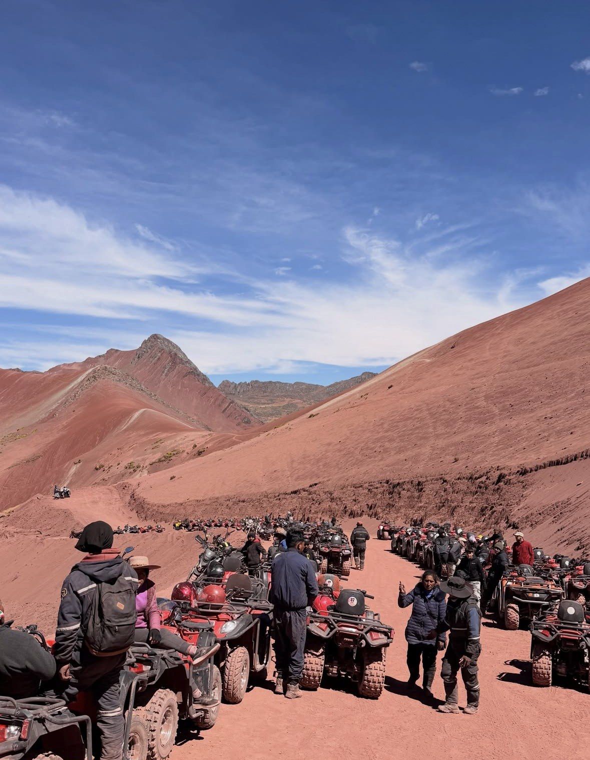
Three formats on this site cover the realistic range. The standard full-day group departure is the default if you are reasonably fit and acclimatised and want the small-hours start that puts you on the ridge while the colour is strongest. The private 08 am departure exists for people who need to set their own pace, stop when they want and avoid being the last one up a hill; it is also the shortest day listed here. The quad-bike trip shortens the distance you cover under your own power and adds the Red Valley, with the last climb and the staircase still on foot.
Pick the format on an honest self-assessment rather than on optimism, and remember that free cancellation up to 24 hours before leaves you room to change your mind if the altitude is not treating you well.
| Tour | From | Duration | Rating | Pace and departure | Altitude support | Best for |
|---|
| Excursion to Rainbow Mountain Full Day Optional Red Valley | from $22 | 12 hours | 4.9 ★ (4062 reviews) | Small-hours start, standard group pace | Oxygen assistance, walking sticks, professional guide | Fit, acclimatised walkers happy with a group rhythm |
|---|
| Private Rainbow Mountain Tour - 08 am departure Skip the Crowds | from $149 | 10 hours | 5.0 ★ (342 reviews) | 08 am private departure, your own pace | Oxygen to hand, experienced guide, private vehicle | Slower walkers, mixed-fitness couples and families |
|---|
| Tour ATV Rainbow Mountain and Red Valley from Cusco | from $90 | 13 hours | 4.7 ★ (110 reviews) | Small-hours start, quad bikes plus the final climb on foot | Oxygen and first-aid kit, safety equipment, team assistance | Anyone wanting less walking, with the staircase still ahead |
|---|
Questions people ask
How many nights should I spend in Cusco before the hike?
Two to three, as a minimum. The CDC advises two to three nights at around 2,450-2,750 m before ascending higher, plus mild exercise only and no alcohol in the first 48 hours at altitude, and Cusco stands at 3,399 m (11,150 ft). Peru's tourism board also says acclimatising is essential before attempting Vinicunca and suggests some cardiovascular work in the days beforehand.
Does hiring a horse make the hike easy?
It shortens the walking, but the hard part stays. The final steep section and the staircase have to be covered on foot regardless, so the steepest minutes of the day are still yours. Plan as though you will walk the top section, because you will.
Is the walk harder in the rainy season?
Yes. From November to April rain and snow can cover the coloured bands and road travel to the trailhead gets significantly slower, which stretches an already long day. May to October is the dry window named by Peru's state agency, with May to September the clearest months. One recent example of what wet weather does: access bridges were damaged by heavy rain and snowfall in February 2026, with a temporary suspension of visits under evaluation.
Can children manage the hike?
Entry is not refused to children, though under 10 years of age the walk is advised against. Small legs face a dark-hours transfer, then 400 to 600 m of ascent starting above 4,650 m, with steps to finish. For families with younger children, Palccoyo needs only 45 to 60 minutes on foot to a summit at 4,971 m.
What should I do if I get a headache on the way up?
Tell the guide and stop climbing. Headache is the cardinal symptom of acute mountain sickness and usually comes with dizziness, fatigue, nausea or loss of appetite, generally 2 to 12 hours after gaining altitude. If resting does not help and things get worse, the CDC says to lose height: 300 m or more of descent usually brings improvement, and oxygen is with the guides on the tours here.
Read also